|
EAGLE SCOUT PEAK
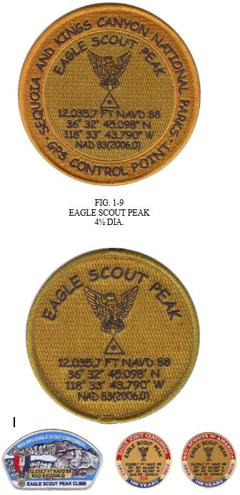
This award was developed and
sponsored by Troop 1210 (Foothills
Church), Rancho Santa Margarita, California. In 2006, five Orange County
Council Eagle Scouts measured the most
accurate to date elevation, latitude
and longitude of Eagle Scout Peak in
the backcountry of Sequoia and Kings
Canyon National Park. The Eagle Scouts
used a Trimble R8 GPS receiver,
and the measurements will become the official U.S. Geodetic Survey
reading. The data appears on the award.
The 4 inch patch is a replica of the
brass GPS Control Point medallion with stem that was forged and is on
public display in the Superintendent’s Office of Sequoia and Kings Canyon
National Park. The medallion was not set in rock on the summit to observe
the “Leave No Trace Philosophy”. The
3 inch patch with button loop is
designed for uniform wear. Successful completion of the requirements
earns both patches. An article about this project was published in the June,
2007 issue of
Point of Beginning
, the most respected journal for the
geodesy and surveying industry in the United States (
www.pobonline.com
Archive of Past Issues).
Requirements:
1. Climb and “summit” Class 2 Eagle Scout Peak in the Sequoia
backcountry, as either an in-and-out trek from the Crescent Meadow
Trailhead, or as part of the High Sierra Trail-Giant Forest to Mineral King
(or Mineral King to Mt. Whitney) High Adventure Award from the Los
Angeles Area Council.
References:
1. Morey K, White M et. al.: Sierra South, Eighth Edition. Wilderness Press,
Berkeley, CA, 2001.
2. Secor RJ: The High Sierra: Peaks, Passes and Trails, Third Edition. The
Mountaineers, Seattle, WA, 2009.
The 3-patches below are a limited edition set. Contact Dennis Crockett at: doctorscoutmaster@gmail.com for details.
|

|